GDT > Transit Fun > Map Vault
A collection of historical and aspirational RTD maps, both official and unofficial for those who love this sort of thing. Enjoy…
1977 RTD System Map
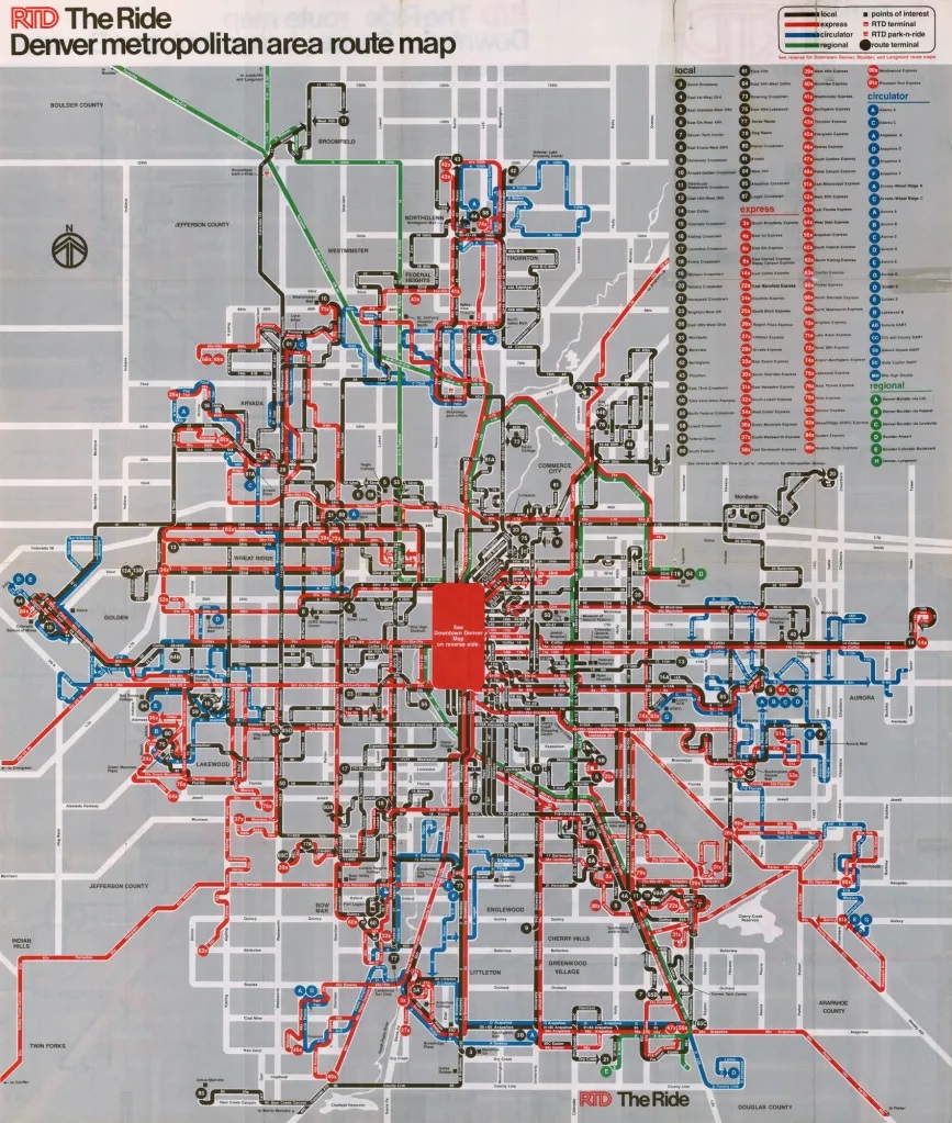
Look at all those express bus routes (in red)…
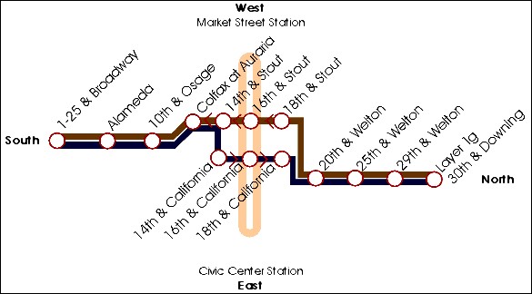
2000
Website Light Rail Map
This map is believed to have been on the fledgling RTD website sometime from 1994 up until 2000. It shows the original ‘Metro Area Connector’ (MAC) light rail system which opened in Oct 1994.
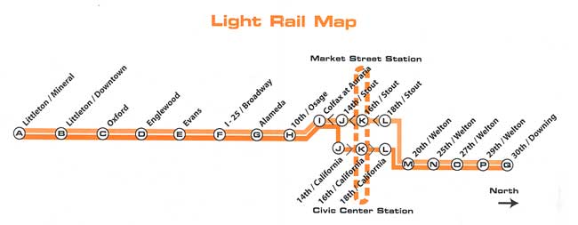
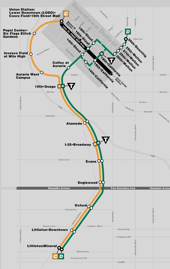
2001
Website Light Rail Map
Updated website map issued after the opening of the Southwest Corridor extension to Littleton – Mineral in Jul 2000. Note the station letters!
RTD Light Rail Maps (2001 – 2005)
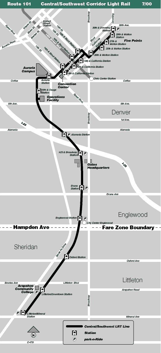
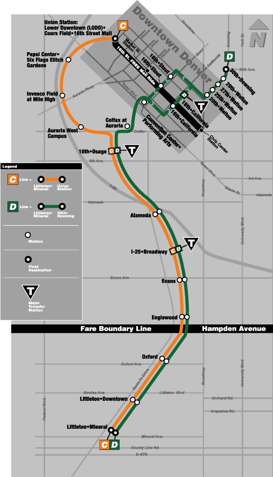
2001
Light Rail Map
Map issued right after the opening of the Southwest Corridor extension to Littleton – Mineral in July 2000.
2002
Light Rail Map
Map issued right after the opening of the Central Platte Valley (CPV) extension to Union Station in Apr 2002.
2005
Light Rail Map
Map issued for 2005. Note the elimination of 14th & Stout station in Nov 2004.
RTD Rail Maps (2006 – 2013)
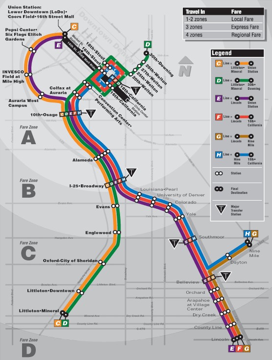
2006
Light Rail Map
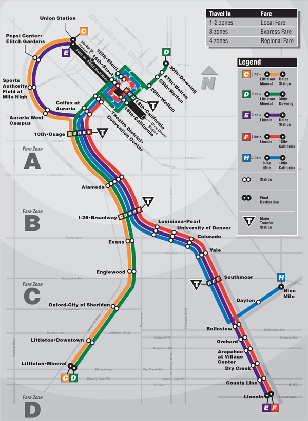
Map issued right after the opening of the Southeast Corridor extension to Lincoln (the “T-Rex” project) in Nov 2006.
2009
Light Rail Map
Map issued to show the permanent suspension of the original G Line. It was replaced by the R Line in Feb 2017.
Jan 2013
Light Rail Map
Map issued for 2013. Note the elimination of the 29th & Welton station that closed that month.
RTD Rail Maps (2013 – 2017)
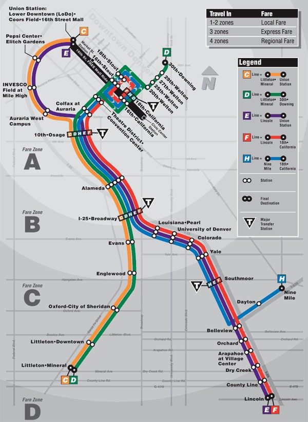
May 2013
Light Rail Map
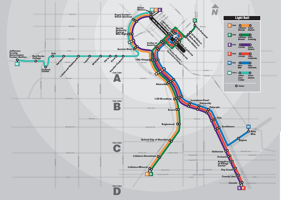
Map issued right after the opening of the W Line in Apr 2013.
2015
Light Rail Map
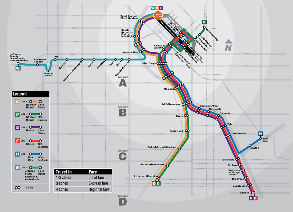
Map issued right after the opening of the Union Station bus concourse and introduction of the Free MetroRide.
Sep 2016
Rail Map
Map issued right after the opening of the A and B lines in April and July respectively. Note the revised fare zones.

Jan 2017
Rail Map
Map issued for 2017.
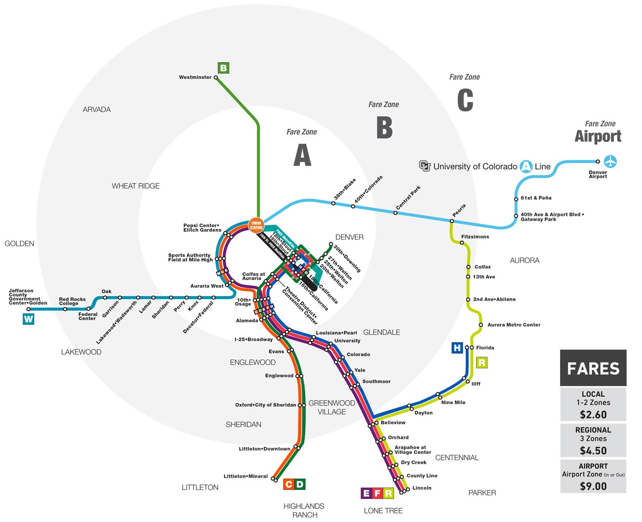
May 2017
Rail Map
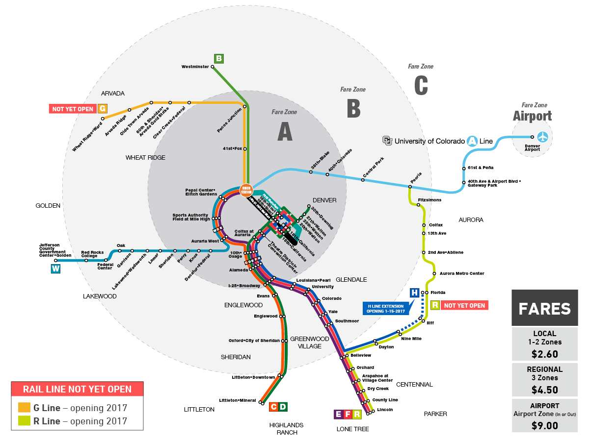
Map issued right after the opening of the R Line and extension of H Line service to Florida in Feb 2017.
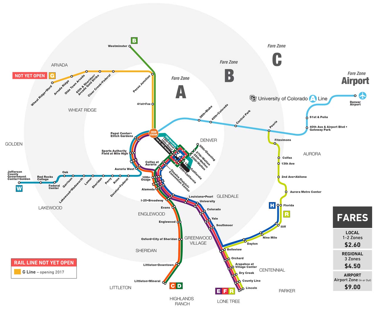
Sep 2017
Rail Map
Map issued to reflect uncertainty regarding the opening of the G Line.
RTD Rail and Flatiron Flyer Maps (2018 – Present)
2018
Rail and Flatiron Flyer Map
New style map issued for 2018 showing Flatiron Flyer route, the splitting of the D Line into two parts and the creation of the L Line.
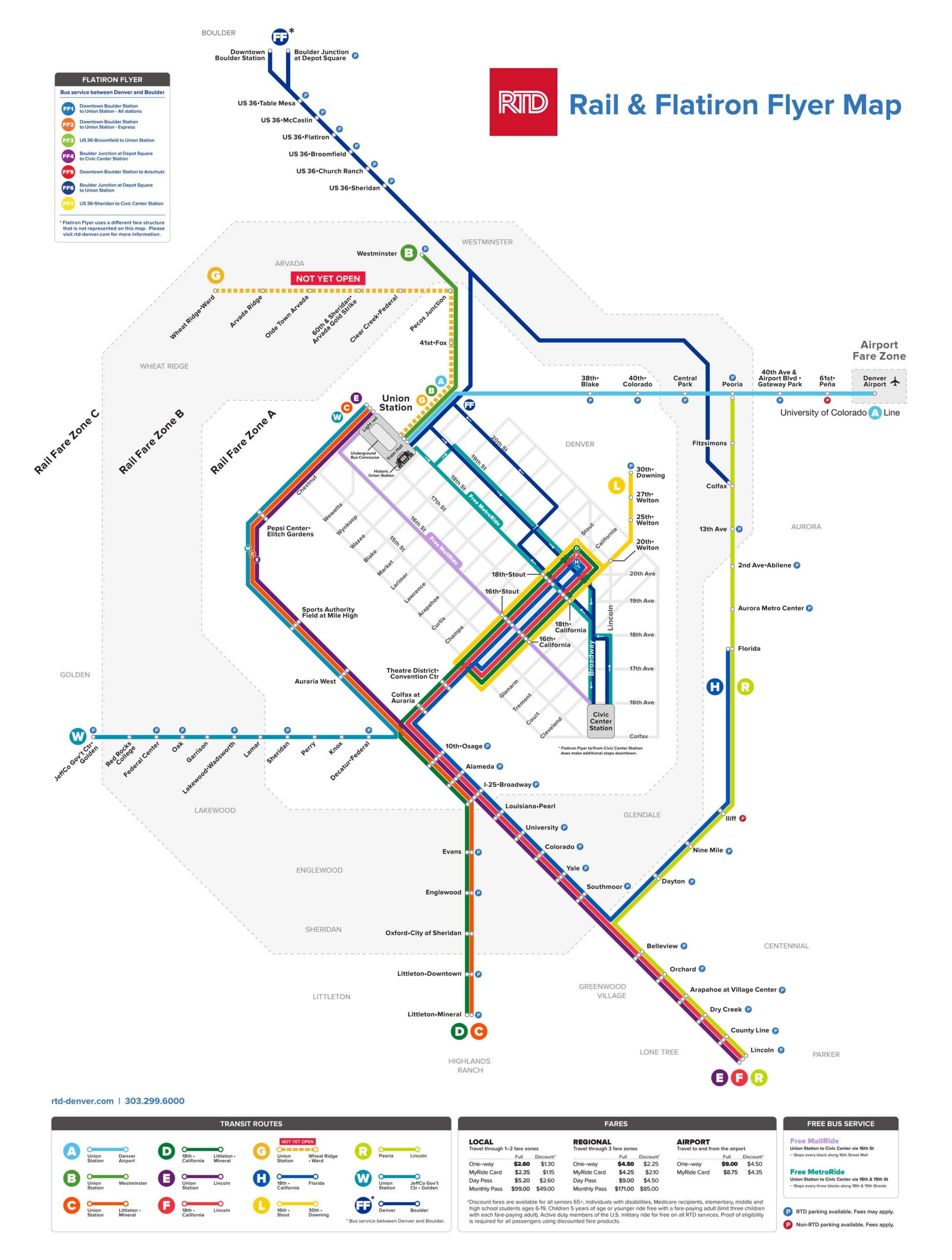
Jan 2019
Rail and Flatiron Flyer Map
Map issued for 2019.
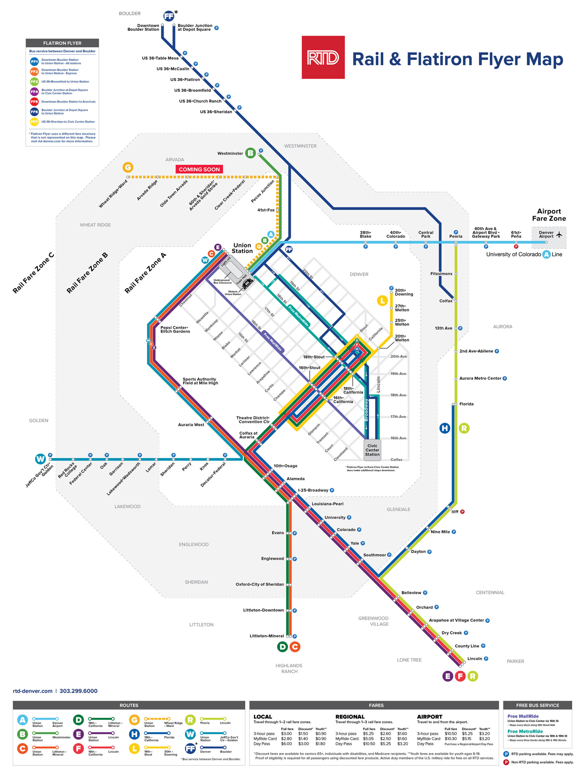
May 2019
Rail and Flatiron Flyer Map
Map issued right after the opening of the G Line in Apr 2019 and the Southeast Light Rail Extension (E, F and R Lines) in May 2019.
Mar 2020
Rail and Flatiron Flyer Map
RTD Rail and Flatiron Flyer map issued at the onset of the Covid-19 pandemic and shows the C and F light rail lines in gray as they have been suspended.
Jan 2023
Rail and Flatiron Flyer Map
Map issued when the permanent suspension of the C and F light rail lines was confirmed. Note the suspended Free MetroRide.
Sep 2024
Rail Map
Map issued as a “rail only” version. Note the removal of fare zones as a result of the 2022 fare study.
RTD Rail Maps – What could have been…
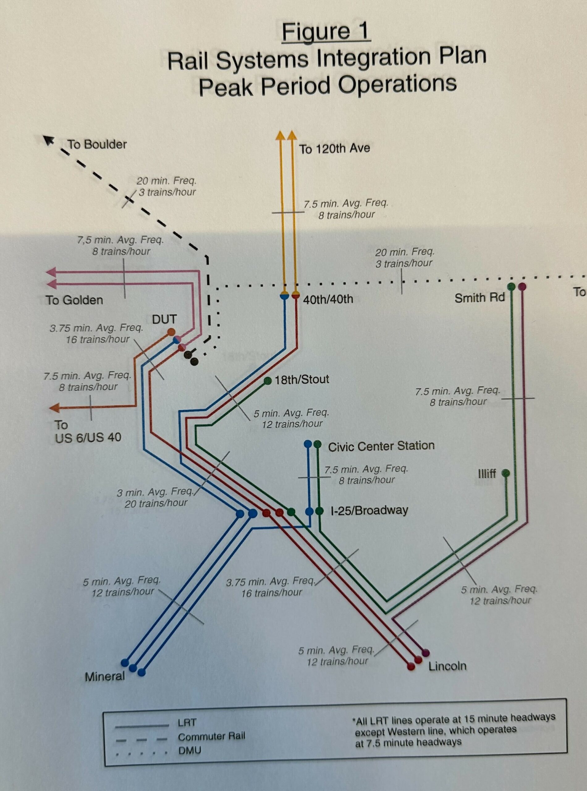
Unknown
Rail Map
A planned rail map showing a light rail system plus commuter rail and DMU service. Note the line to Civic Center and the extension from 40th & Colorado onto what is now the N Line alignment.
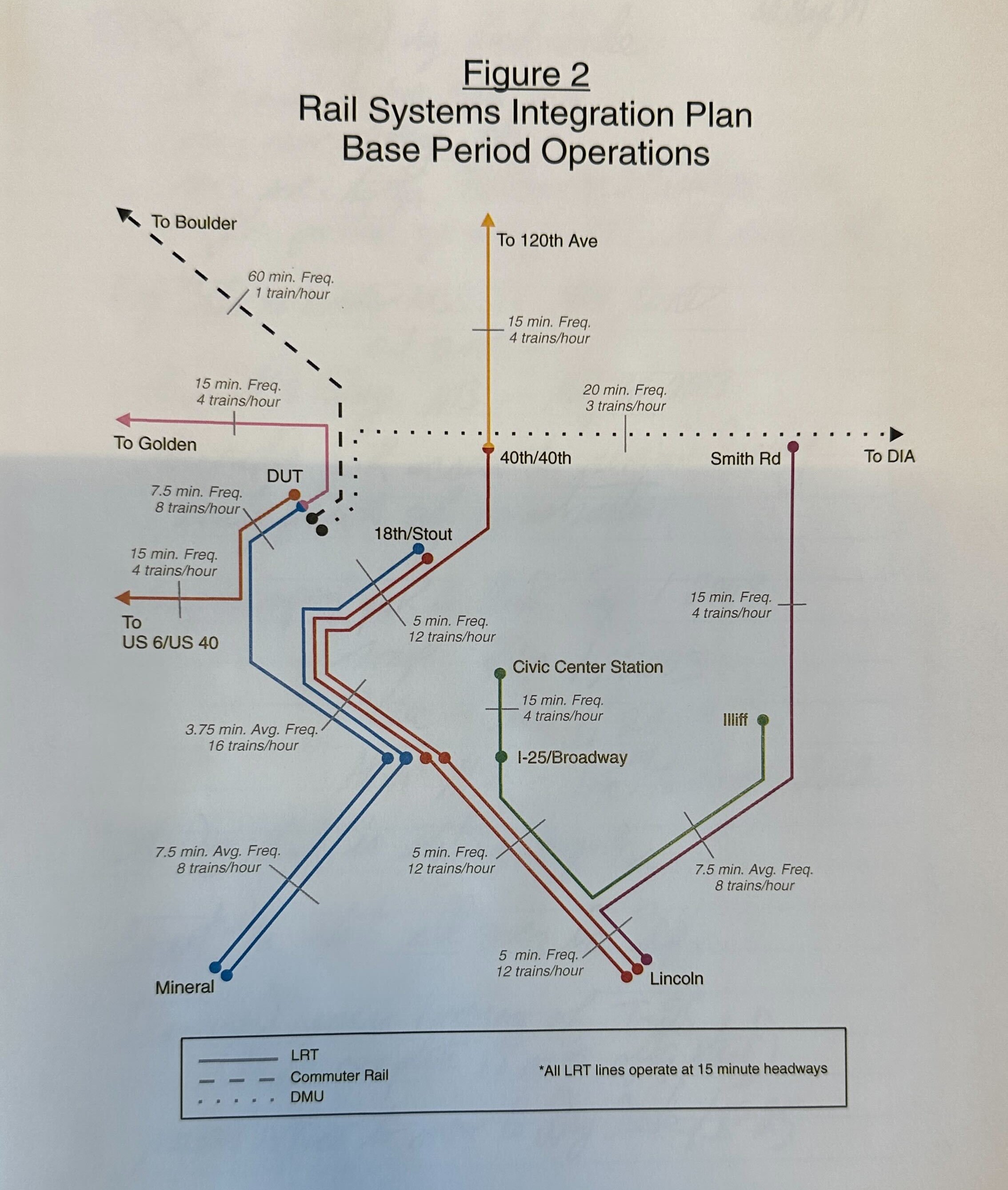
Unknown
Light Rail Map
A non-peak version of the rail map, showing some restricted operations.
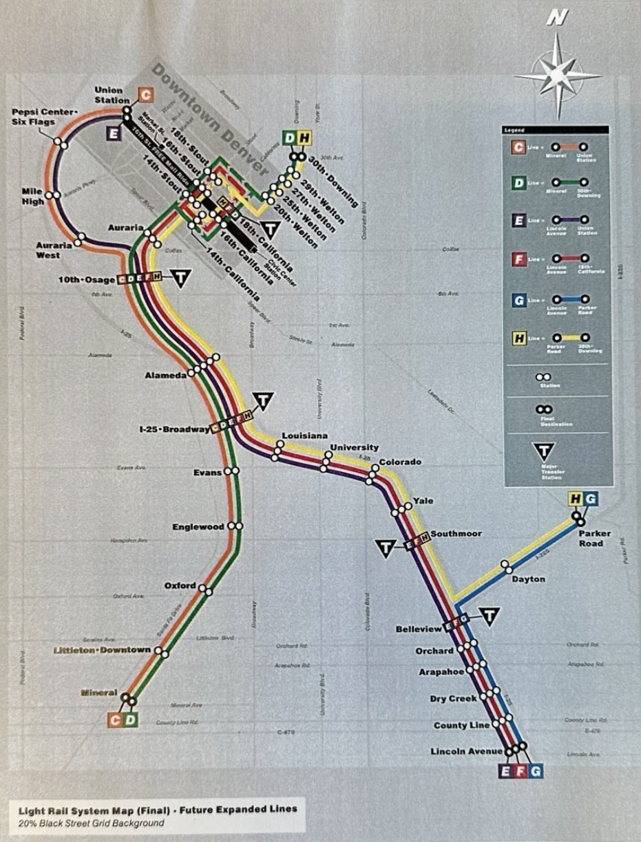
2005
Light Rail Map
This map is believed to have been issued around 2005 showing the projected completion of the ‘T-REX’ project light rail lines and plans for the H Lin to serve 30th & Downing Station.
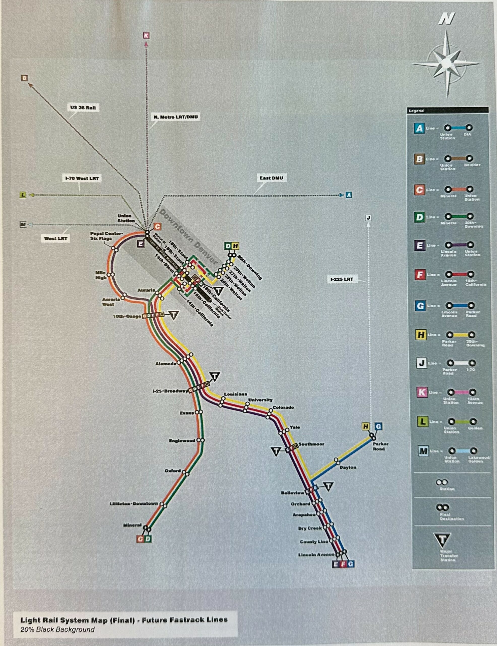
2005
Rail Map
2005 map showing the projected completed light rail lines with light rail and DMU plans for what would become the A, B, G, N, R and W lines.
Aspirational RTD System Map, Brent Mowery
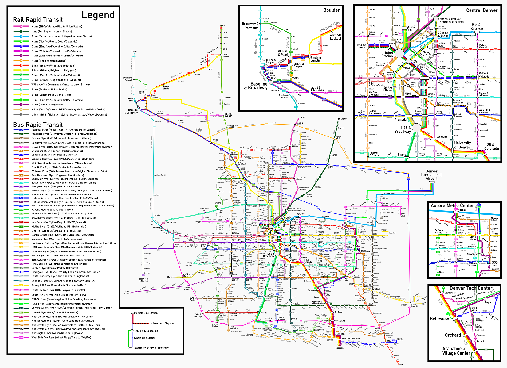
An aspirational map of future RTD service.